Survey to Identify High-Risk Areas; Will Run from October 21 to November 21
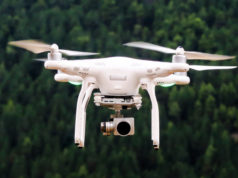
In response to the rising incidents of landslides and land subsidence in Himachal Pradesh’s capital, Shimla, the State Disaster Management Authority (SDMA) is set to launch a drone-based LIDAR (Light Detection and Ranging) survey. This survey, which will run from October 21 to November 21, aims to thoroughly assess the city’s geographical conditions and identify areas most vulnerable to landslides. The initiative comes at the recommendation of the Geological Survey of India (GSI), reflecting growing concern over Shimla’s environmental stability.
To ensure the smooth operation of the survey, necessary formalities for drone usage in Shimla’s no-fly zones have been completed, and permission has been granted for areas under the army’s control. A consultancy firm has been tasked with carrying out the LIDAR survey and is expected to submit its comprehensive report by November 21.
Deputy Commissioner Anupam Kashyap emphasized the importance of this initiative, noting that the survey’s primary goal is to accurately assess the instability of Shimla’s terrain and prepare for future risks. “This survey will not only enhance the safety of Shimla’s residents but will also contribute to the city’s infrastructure development,” he added.
How the Survey Will Work
The LIDAR technology used in this survey will create a detailed 3D image of Shimla’s geographical features through laser pulses emitted from drones. These pulses reflect off the ground and return to sensors, providing precise data on the depth, height, and surface of the terrain. This information will be critical in identifying areas prone to landslides and will help pinpoint the underlying causes of these dangerous incidents. With this knowledge, the SDMA hopes to implement effective preventive measures to minimize future risks.
Landslides: A Growing Threat in Shimla
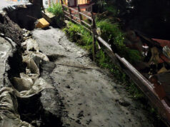
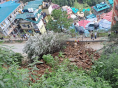
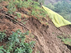
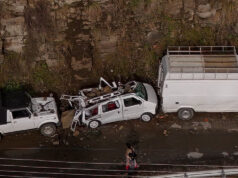
Shimla has seen a sharp increase in landslides over the past few years, particularly during the monsoon season, when heavy rains destabilize the already fragile terrain. These landslides have led to widespread destruction, including blocked roads, damaged homes, and the displacement of numerous families. Experts attribute the worsening situation to unchecked construction on the hills and environmental imbalances, further straining the city’s stability.
The implementation of drone-based LIDAR technology is expected to be a game-changer in tackling Shimla’s landslide crisis. By enabling a more accurate understanding of the city’s topography and vulnerabilities, authorities will be better equipped to devise sustainable solutions to mitigate the impact of landslides. With the increasing threat of climate change and urban expansion, such advanced technological interventions are becoming essential in ensuring the safety and long-term sustainability of hill cities like Shimla.


