
Findings offer roadmap for climate-resilient farming and smarter land management across India’s hill states
By Dr Sahil Sharma
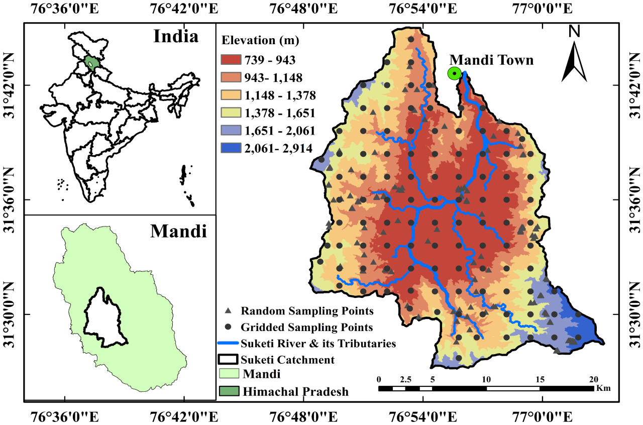
Mandi — A study by researchers at the Indian Institute of Technology (IIT) Mandi has uncovered how elevation and terrain type dramatically affect soil quality in the Himalayan region, offering new insights that could reshape agriculture and land use policy in India’s hilly states.
Conducted over 57 weeks in the Suketi River watershed — a 422-square-kilometre area in Himachal Pradesh and part of the Beas River basin — the study is the first of its kind to comprehensively map soil behaviour across different elevations and landforms using machine learning and geostatistical tools.
High Elevations, Rich Soil — But Drier Conditions
The research, led by Sahil Sharma and Deepak Swami, found that elevation is a “hidden driver” of soil function. Forested areas at higher altitudes had richer organic content, thanks to dense vegetation and leaf litter. However, these same areas suffered from lower soil moisture and cooler temperatures, limiting their potential for crop cultivation.
“Elevation affects not just soil texture, but critical factors like moisture retention, salinity, and nutrient content — all of which are vital for agriculture,” said Sahil Sharma, the lead author of the study.
Key trends observed with increasing elevation included:
- Increase in sand and organic matter
- Decrease in clay, silt, moisture, and soil temperature
- Improved organic carbon levels but reduced water retention
Valley Farmlands: Fertile But Vulnerable
In contrast, the farmlands located in lower valleys showed higher soil temperatures and electrical conductivity, largely due to intense fertiliser use. These areas, while productive, are at greater risk of salinity build-up and soil erosion. Grasslands, particularly those with finer soil textures, showed the highest soil moisture content among all terrain types.
The study highlights how these variations create both challenges and opportunities for land use planning. For example, high-altitude zones may benefit from conservation-based approaches like agroforestry, while valley regions require strategies to manage fertilizer runoff and erosion.
Tools for Smarter Farming and Policy
The researchers used advanced modeling tools to create detailed soil maps that could become vital resources for both farmers and policymakers. These maps can help local farmers make informed decisions on crop selection based on elevation, moisture retention, and seasonal variations. They can also assist government agencies in identifying erosion-prone zones and targeting soil conservation programs more effectively.
Broader Implications
Experts believe the findings have far-reaching implications not just for Himachal Pradesh, but for hilly states across India and the wider Himalayan belt. The researchers recommend expanding the study using AI and remote sensing to build robust land-use models for other mountainous regions.
“This is more than just a scientific study — it’s a practical guide for climate-resilient agriculture in India’s hill states,” said Deepak Swami, co-author of the research.
As climate change continues to impact rainfall patterns and soil health in vulnerable mountain ecosystems, such data-driven insights could become essential tools in the push toward sustainable farming and ecological restoration.


