
By Dr Sahil Sharma
In a study that could transform water management in hilly terrains, a team of Indian researchers has unveiled critical insights into soil moisture dynamics within the lower Himalayas. Conducted over a span of 57 weeks, the study meticulously measured soil moisture levels across the Suketi River watershed, revealing how natural terrain features impact moisture retention in soil—a factor crucial to agriculture, climate modelling, and flood forecasting.
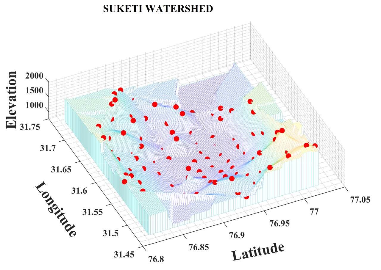
The research, spearheaded by engineers from IIT Mandi and IIT Jammu, covered a vast 422-square-kilometer area in the Mandi district of Himachal Pradesh. The Suketi watershed—characterized by elevations ranging from 739 to 2914 meters and a mix of forests, grasslands, and farmland—posed a unique challenge due to its diverse terrain.
To tackle this, the team installed a network of sensors across 104 grid locations spaced evenly every 2 kilometres. Using advanced equipment, they collected more than 71,000 soil moisture readings, capturing the effects of all seasons from early 2021 through early 2022.
The study’s key breakthrough lies in determining how many monitoring points are truly necessary. By applying statistical models, the researchers discovered that just 30 strategically chosen locations are sufficient to represent the watershed’s spatial moisture variability—drastically cutting down the cost and complexity of large-scale monitoring. Even more remarkably, just 8 of those sites could capture temporal changes with impressive accuracy.
Their analysis pinpointed two major natural factors behind the moisture patterns: elevation and the amount of sand in the soil. Areas at higher altitudes and those with sandier soils tended to retain less moisture, while mid-elevation zones with loamy or silty soils maintained more stable moisture levels over time.
These findings have wide-reaching implications, from improving irrigation strategies in agriculture to enhancing the accuracy of satellite moisture data. They also offer a cost-effective way for policymakers to monitor water availability in remote or mountainous regions.
Although the study did not include satellite data validation due to resource constraints, the researchers hope future studies will build on this work, especially in understanding land use and elevation effects in greater detail.
Soil moisture, though often overlooked, plays a vital role in our everyday lives. It influences crop yields, affects how much water runs off into rivers during storms, and even shapes local weather. As climate patterns shift and water resources become more strained, studies like this one are essential for sustainable development in fragile ecosystems like the Himalayas.


