
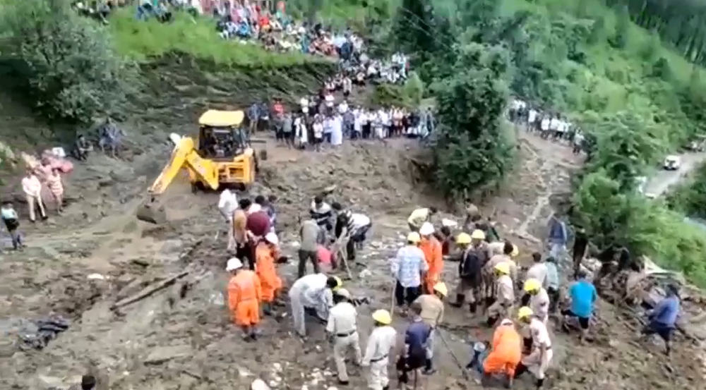
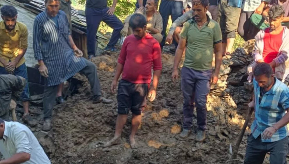
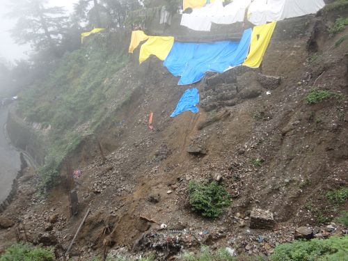
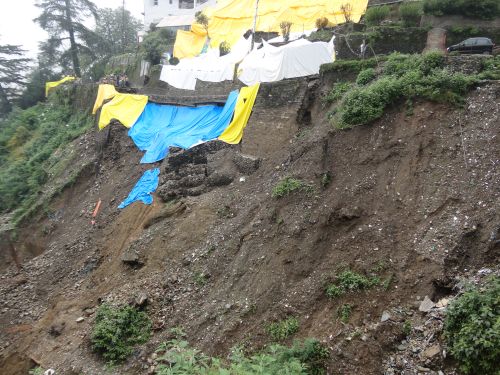
Uttrakhand’s Joshimath is in panic mode ever since cracks started appearing in the roadways, temples, houses, and commercial buildings. As per the latest reports, the number of damaged houses has now increased to 723. The hill town is experiencing land subsidence, which is a phenomenon where ground level begins to ‘sink’ over time. Consequently, the government has issued guidelines to evacuate the houses and buildings that are at high risk of collapse in Joshimath.
But the question is why the land in the region is sinking? What are the fundamental reasons leading to this phenomenon? Let’s break it down.
Land subsidence is a natural occurrence where the ground begins to lower or sink. It often happens when people are extracting too many minerals or water from the ground, which further leads to the subsidence of the land. It’s also the result of various natural processes, such as the movement of the earth’s crust or soil compaction. Subsequently, there occurs a chain of events that leads to the cracking and collapsing of the land surface, as well as causing flood hazards.
Why is Joshimath sinking?
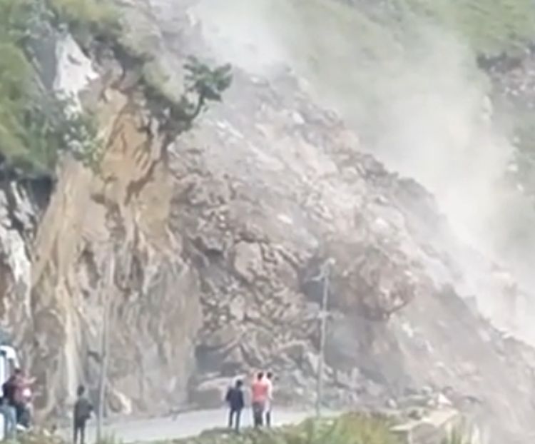
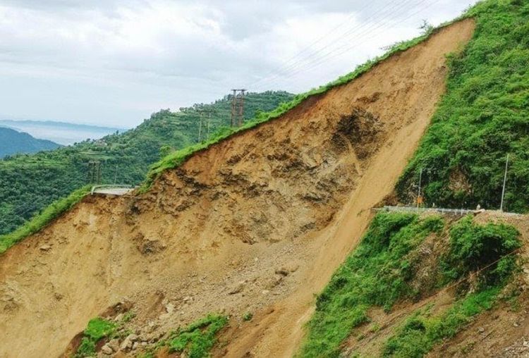
There are various factors leading to the subsidence of Joshimath, such as extreme weather events, geological factors, increasing population and excessive construction, flash floods, and deforestation. One of the primary reasons for the land subsidence in the town is the relatively loose soil, deposited by landslides triggered by previous earthquakes. The floods of June 2013 and February 2021 led to slope instability and toe erosion in this region, increasing the subsidence risk.
Geological factors also play a major role in the subsidence of this town, according to the 2022 study by Uttarakhand State Disaster Management Authority (USDMA). It is because this town is located on the Vaikrita Thurst (VT), which is a tectonic fault line. Moreover, it lies closer to other major geological fault lines: the Pandukeshwar Thrust (PT) and the Main Central Thrust (MCT). Due to the tectonic activity, Joshimath has a higher risk of collapsing.
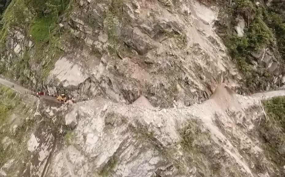
The increasing population and growing hydroelectric projects in the region are leading to unplanned construction in Joshimath, making the landslide-prone area more vulnerable. There are several hydroelectric schemes such as the Vishnugad HE project, that are being constructed around Tapovan and Joshimath. For constructions like the Helang bypass and so on, Border Roads Organisation (BRO) uses heavy machinery, which also loosens the soil structure and makes it unstable. Given the current ecological threat to the town, the construction around Joshimath has been banned by the government.
Is it a warning from the Himalayas?
Joshimath’s horrific events seem to be a stern warning from the Himalayas. Although natural calamities are impacting only one region at the moment, other neighbouring states such as Himachal Pradesh are also threatened by the unabated and unplanned construction and topographical changes happening in and around the young mountain range.
The ecology, biodiversity, topography, and environment of some districts in Himachal Pradesh, including Mandi, Chamba, Kangra, Shimla, and Kullu are quite similar to Joshimath’s. These regions are also prone to both manmade and natural hazards. The main hazards are the risk of landslides, flash floods, avalanches, snow storms, dam failures, draughts, wildfires, and industrial or chemical hazards.
Susceptible regions in Himachal Pradesh
In the past, the state has already experienced 80 earthquakes with a magnitude of 4 and more on the Richter scale. According to the BIS seismic zoning map, the five major districts in the state have around 53 to 98 per cent of the area prone to the severest earthquake intensity of Modified Mercalli scale IX or more. These districts include Mandi (97.4%), Kangra (98.6%), Hamirpur (90.9%), Kullu (53.1%), and Chamba (53.2%). The rest of the areas in these districts are at risk of severe intensity VIII.
Sadly, most of the house types in these regions fall under Category A. It means that these houses consist of walls made of unburnt bricks, clay mud, or random rubble masonry without earthquake-resisting factors. Such houses are at high risk of collapse if an earthquake of intensity IX occurs in the future. This will cause severe damage known as “destruction” with partial collapses and large cracks even within the intensity VIII areas.
Moreover, the burnt-brick houses in Himachal Pradesh come under Category B and don’t have earthquake-resisting features, like roof typing and durable cement mortar seismic bands. These houses are more liable to face severe damages in the intensity IX and VIII if an earthquake occurs.
Manali and Dharamshala are located in seismic zone V, while Shimla is situated in seismic zone IV. These three tourist spots in Himachal Pradesh are constantly under ecological pressure to entertain more tourists, provide them with comfortable accommodations and a sufficient amount of water. These demands lead to exploitation of natural resources, deforestation and unplanned and haphazard construction. Consequently, the land becomes unstable and vulnerable to natural elements over time.
Other types of natural hazards in HP are the increased risks of landslides that occur during monsoons or triggered due to high-intensity earthquakes. All this is the result of some type of inappropriate human activities or other. For instance, anthropogenic activities like road cutting, deforestation, terracing, and alterations in crops that need extreme watering.
Even the widespread flooding occurrences in the state are due to its topographical nature. The heavy monsoon rains cause extensive floods in the Shivalik range and lower and mid-Himalayan peaks. This means that the geologically young Himalayan ranges are vulnerable to catastrophes at a far greater intensity.


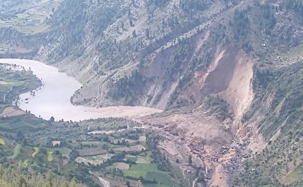
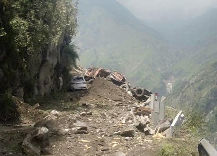

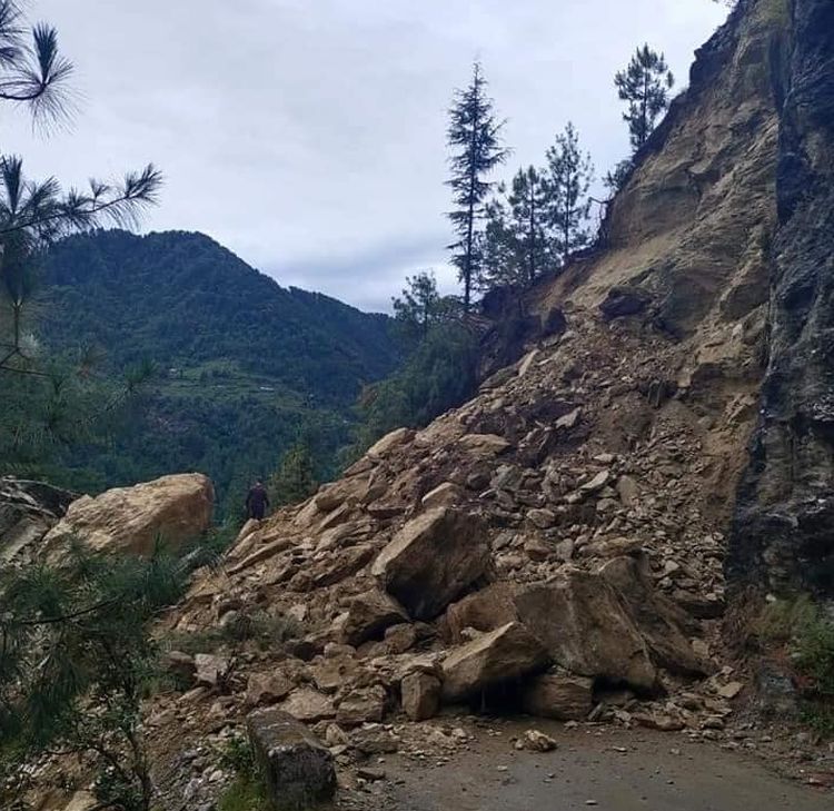
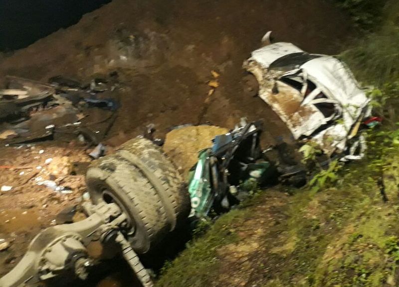
Typically, flash floods and bank erosion are the big concerns in the upper area of the Beas and Sutlej valley because of the steep riverbanks and rapid river flows brought on by heavy rains. The regions around these rivers also detect flashes brought on by cloudbursts, transient river channel blockages, and glacial lake outbursts. As a result of embankment breaches, dwellings, irrigation/flood control systems, and other utilities are also seen to be damaged. The increasing work on road connectivity has also led to the exploitation of the land in both Himachal and Uttarakhand.
If the practice is not discouraged and immediately halted, these two Indian hilly states will have to bear the wrath of nature through a series of natural disasters.
It’s time to take action
For addressing the problem of Joshimath’s land subsidence, as well as increasing natural hazards in other Himalayan regions, authorities need to take some long-term stability measures to mitigate the risks of ongoing and forthcoming hazards. It may include proper planning and regulation of various construction projects in the Himalayan area.
Here’s a proposed action plan that authorities may consider:
- Identify ecologically vulnerable places
- Demolish the houses that are already damaged or about to collapse
- Relocate people living in high-risk areas to safer places
- Conduct tests to check the construction feasibility in the mountains
- Monitor the vehicular movement on roads and other mountainous areas due to the development works


